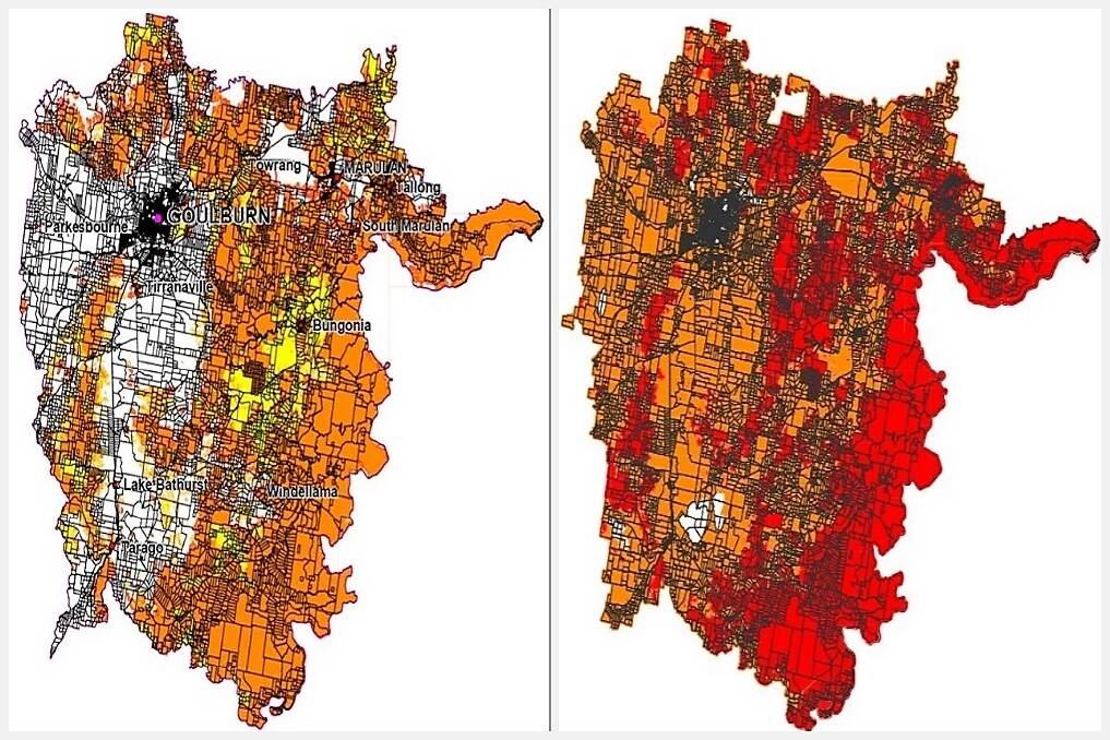
Almost all land outside the urban areas in Goulburn Mulwaree will be re-classified as “bushfire prone” on a new map produced by the council.
Subscribe now for unlimited access.
$0/
(min cost $0)
or signup to continue reading
The draft Bushfire Prone Land Map is being presented to Tuesday’s Goulburn Mulwaree Council meeting.
A report accompanying the map said the extent of mapped bushfire-prone land has increased greatly since the last map was produced in 2003.
The new map shows there has been changes in vegetation in the area since then.
“This has occurred to the west of Tarago, Lake Bathurst and to south of Bungonia,” the report by council’s Emma-Jayne Leckie said.
The new map has ramifications for land purchasers and developers because it is the trigger for the consideration of bush fire protection measures
It also will affect building code requirements for new developments.
“Land which was not identified on the current map as being bushfire prone, but which is identified in the draft map as being bushfire prone, will have to comply with standards for any new construction on the land,” the report said.
“The owners will also have to demonstrate how bushfire risk has been assessed and will be managed in any subdivision of the land.”
The Rural Fires Act established The Rural Fire Service (RFS) in 1997 and the Bushfire Prone Land Maps – as a means to protect human life and minimise the impacts on property from the threat of bushfire. The draft map will then go to the RFS for changes prior to certification.


