The Crookwell Road has been re-opened at the Goulburn end, following heavy overnight snow.
Subscribe now for unlimited access.
$0/
(min cost $0)
or signup to continue reading
Motorists reported the surface as "treacherous" from about Mount Wayo, where the falls started, through to Crookwell as ice started forming on the road.
The road was re-opened to traffic at the Crookwell end about 8.45am and at the Goulburn end, shortly after 9.30am.
READ MORE:
The SES had closed the thoroughfare through to Chinamans Lane, Goulburn at about 4am Wednesday due to the conditions.
Crookwell residents reported a thick blanket of snow around the district. By 9am it was starting to melt in the main street but remained deep in grassed areas.
Roslyn landowner, Katrina Nixon, said four to five inches of snow had fallen since 10pm Tuesday. She was thankful on Tuesday that the strong winds had dropped. The snow followed more than 25mm of rain.
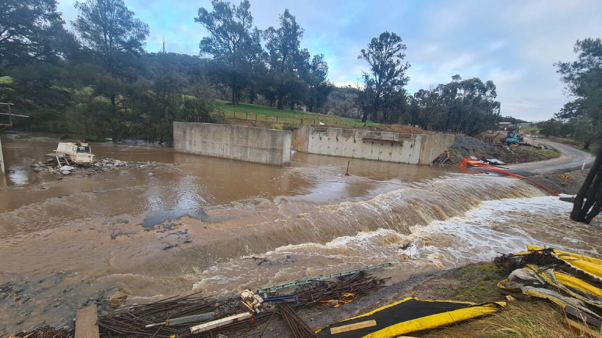
The snow and rain has triggered other road closures in Upper Lachlan Shire. These are:
- Peelwood Road at Peelwood Creek.
- Tyrl Tyrl Road at Bolong River
- Taralga-Oberon Road at the Abercrombie River
- Taralga-Oberon Rd at Curraweela Creek causeway
- Golspie Road at Reedy Creek, just off Peelwood Rd
- Backarm Rd is closed at the Tarlo River causeway (1 metre under water)
- Pejar Road at the First Creek and Middle Creek Causeways (Goulburn Road End) due to current water levels.
- Bevendale Rd at Lachlan River Crossing
- Julong Rd at No 2 bridge bypass
In addition, the wild weather has impacted Grabben Gullen Road between Crookwell and Gunning. The road is not entirely closed but many trees had fallen, blocking the road, the council reported.

A spokesman said the Gunning Transfer Station would remain closed until the Grabben Gullen Road was trafficable.
SES Argyle Local commander Robert Bell said a crew was called out to the Crookwell Road in the early hours to assist a motorist whose car had become stuck in snow.
In Goulburn Mulwaree, the council advised of the following road closures:
- Bullspit Road
- Mills Road
- Chinamans Lane - closed at Sooley Dam
- Gurrundah Road - closed between Coopers Lane and Foord Road
The river walkway is from Marsden Weir to Tully Park is also closed due to flood waters.
Goulburn Airport recorded 42mm of rain from Tuesday to 9am Wednesday, according to the Bureau of Meteorology.
Our journalists work hard to provide local, up-to-date news to the community. This is how you can access our trusted content:
- Bookmark our website
- Follow us on Twitter
- Follow us on Google News
- Make sure you are signed up for our breaking news and regular newsletters


